Back to the BIM & IFC blog
Digital twins · 2026-10-03 · 6 min
Shanghai in 3D: Combining IFC Buildings and Urban Context Without Losing Reality
From the Oriental Pearl to the Yuyuan gardens: how we built a 3D context that keeps streets, entrances and open spaces, and where its limits lie for a BIM project.
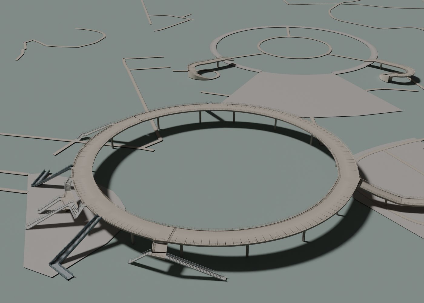 Review render of the Mingzhu ring: an approximate reconstruction over OSM mapping
A useful 3D map does more than place buildings on an aerial image. It has to explain what connects to what, what passes over what, and which spaces stay open. Shanghai let us test those relationships: pedestrian bridges in Lujiazui, large railway stations and historic gardens inside a dense city.
Key takeaways
- The IFC provides the building elements; the mapping provides the context. Their accuracies are not interchangeable.
- Continuity of entrances, tracks and courtyards matters more than adding decorative detail.
- You can inspect an IFC reconstruction of the Oriental Pearl and see what information it contains.
 Explanatory diagram, not to scale. It does not represent measured dimensions of Shanghai.
What our 3D Shanghai actually represents
An IFC model organises the elements and properties of a building. The map places streets, water, parks and infrastructure around it. Combining them helps explain an entrance, how a volume fits, or how it relates to public space. The condition is that they share a consistent placement and that the reader knows where each layer comes from.
| Layer | What it provides | What it does not prove |
|---|
| IFC | Elements and properties from the file | That it is an as-built model |
| OSM mapping | Available footprints and tags | Complete coverage or survey accuracy |
| Procedural geometry | Volume and detail for visualisation | Measurements of undocumented elements |
In this case we use IFC reconstructions of landmarks and map context. We do not offer a complete survey of Shanghai or a connection to its day-to-day operation. That distinction lets the scene be used for communication and visual review without attributing to it an accuracy its sources do not provide.
Check the placement before adding detail
If the whole context appears shifted by several blocks, check the coordinate system before moving individual buildings. Then check orientation and scale against recognisable features. Finally, compare elevations: resting the IFC and the map on different vertical references can make an entrance float even when the plan looks right.
To set up your own file, see the guide to a georeferenced IFC on a 3D map. Here we focus on the quality of the Shanghai context, not on repeating the georeferencing procedure.
Three mistakes Shanghai forced us to solve
In Lujiazui, a bridge does not end at the edge of its deck: stairs, lifts and landings matter too. At the stations, extruding the concourse as a solid block can bury the tracks. In Yuyuan, filling every polygon erases courtyards and islands and changes how the garden reads.
The common lesson was to keep relationships. A road can remain a road while a bridge carries it. A park can contain a hole. A roof can shelter an open space. Textures do not solve these problems: the organisation of the geometry has to work first.
The criteria and limitations of the work are documented in our Shanghai case. [case]
Explore the Oriental Pearl: from object to context
Oriental Pearl: IFC4 reconstruction
Approximate model, not as-built. This demo shows the building; to review the urban context, open the full viewer and turn on the map.
IFC4 · 21.2 MB
Open the interactive IFC viewer
- Inspect the main volumes Load the demo and compare its silhouette from several angles before zooming in on details.
- Look up elements and properties Select pieces of the IFC. Tell information in the file apart from the map geometry that will appear in Map mode.
- Review the relationship with the street In the full viewer, load the same demo from the gallery and turn on Map mode. Compare an aerial view with one close to the ground.
The file is our reconstruction; it does not come from the building’s original model. Its sources and decisions are described here. [model]
How to present a review without overstating its accuracy
Prepare an aerial view that explains the site, another at street level and a close-up of the connection you want to discuss. Note what belongs to the IFC, what comes from the map and what is approximate. If a structure is missing, check the data coverage: its absence on screen does not prove it does not exist.
When you reuse a capture, keep the map attribution and state that the reconstruction is approximate. The useful outcome is a clearer spatial decision. More buildings or more polygons on screen do not, on their own, prove greater fidelity.
Frequently asked questions
Is this a digital twin of all of Shanghai?
No. It is a BIM/GIS visualisation with IFC reconstructions and map context. It implies neither complete coverage nor a connection to sensors or real-time operational data.
Is the demo the original IFC of the Oriental Pearl?
No. It is an approximate reconstruction by IFC Viewer Online, with its sources and limitations documented; it is not an as-built model.
Can I use the map to check site distances?
The illustrative scene is not enough. Coordinates, elevations, provenance and tolerances must first be validated against control points.
Keep exploring the Shanghai case
Shanghai in 3D: Combining IFC Buildings and Urban Context Without Losing Reality