Back to the BIM & IFC blog
Digital twins · 2026-10-03 · 6 min
Parks and Courtyards in 3D Maps: What We Learned From Yuyuan and Jing’an
Trees inside plazas, water over islands and covered courtyards: three mistakes that make a map worse however detailed it is. How we tackled them in Shanghai.
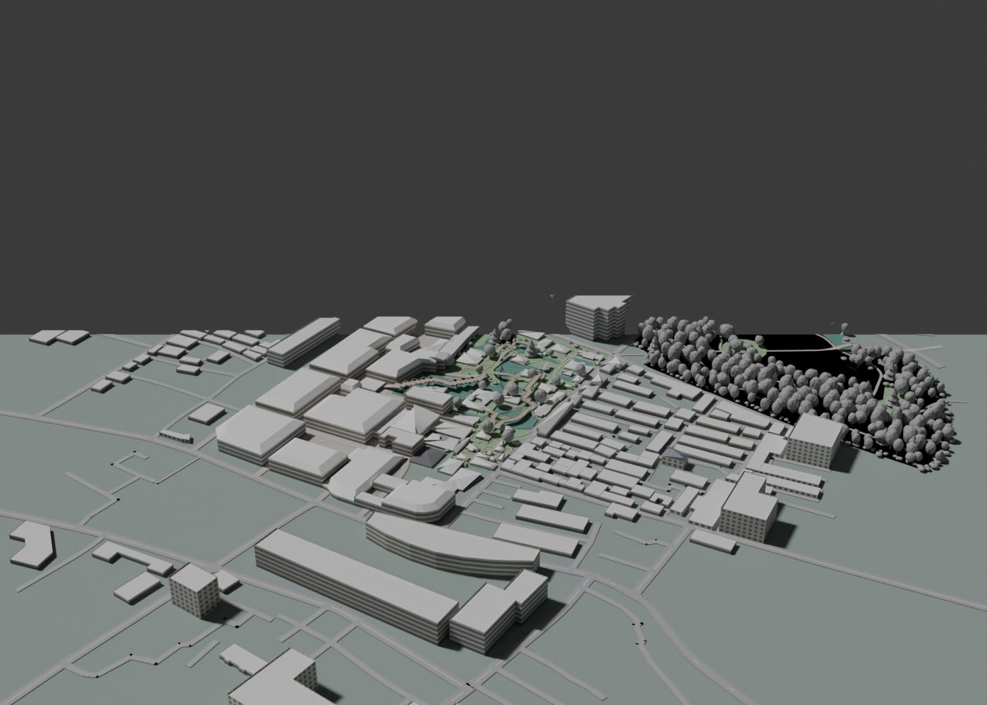 Approximate map-based reconstruction of Yuyuan reviewed in Blender
In a garden, the space between objects matters as much as the objects. If the lawn covers a courtyard or the water fills an island, the place stops reading correctly even if every tree has thousands of polygons. Yuyuan and Jing’an let us review that spatial structure.
 Explanatory diagram, not to scale. It does not represent measured dimensions of Shanghai.
The visual reference is not a placement plan
The municipal reference describes Yuyuan through pavilions, ponds, rockeries and traditional architecture. [garden] That description guides the visual comparison, but it provides no coordinates for placing rocks or inventing pavilions. To position the pieces we start from the available mapping.
The difference is practical: you can aim for a more faithful composition without presenting as measured what is only plausible. A useful reconstruction makes explicit where the known footprints end and where the representation decisions begin.
How to keep a polygon’s holes
A surface can have an outer boundary and several inner rings. [rings] The renderer must generate triangles that leave those interiors open. Storing the hole in the data is not enough if it then vanishes when the mesh is built.
The rule affects lawns, water and roofs with courtyards. An island’s edge must also count as a shoreline when computing how the water looks. Measuring only to the outer perimeter makes the water next to an island behave visually like the middle of the pond.
Vegetation that respects plazas and paths
A pedestrian plaza is usually a surface, not a line. Excluding trees only along its perimeter keeps the edge clear and lets vegetation fill the centre. Procedural placement must query the whole paved area, as well as buildings, water and railway corridors.
Holes must also be kept when seeding trees and shrubs. Fixing the lawn and leaving the vegetation generator untouched produces an open courtyard with tree trunks inside. We review both processes separately because they share data but build different geometry.
Fountains and furniture without inventing the garden
The average of the vertices of a concave fountain can fall outside its basin. To place a jet symbol you need an interior point and a size limited by the nearest edge. Distance to a vertex is not enough: an edge can pass much closer to the chosen point.
We removed randomly generated pergolas and limited ground furniture to suitable paths. A visually believable position is not a documented one. It is worth telling illustrative vegetation apart from structures the mapping explicitly identifies, especially when a capture is shown outside the viewer.
Temples: model the buildings, not the whole precinct
Geometry review of Yuyuan during development. Map footprints, undocumented heights and vegetation are approximate. Blender materials do not reproduce the viewer’s shaders.
A religious precinct can contain several buildings and open spaces. Extruding its boundary as a single volume erases the courtyards. In Jing’an we checked the precinct and the main hall’s footprint separately; in Yuyuan we kept tagged roof shapes that used to be flattened.
This improves how the whole reads, but it does not reconstruct exact eaves, ornament or supports. A canopy documented as an open roof needs a void beneath it. A temple, a mosque and a commercial building need different criteria: being in Shanghai does not justify giving them the same shape.
| Visible error | Likely cause | Check |
|---|
| Water over an island | Inner ring lost | Triangles and inner shorelines |
| Trees in a plaza | Only the perimeter was excluded | Whole paved area |
| Fountain outside its basin | Centre computed as an average | Interior point and distance to the edge |
| Temple as a block | Precinct mistaken for a building | Individual footprints and courtyards |
A test you can repeat in any park
Review the place without trees first: identify courtyards, water, plazas and buildings. Turn on vegetation and check which spaces it invades. Add furniture last. If a layer makes the earlier ones harder to read, investigate its exclusions before increasing the detail.
Keep close-up and distant views. The first reveal clashes; the second show whether the organisation of the place survives. The case’s sources and limits are documented so that an attractive image is not mistaken for a survey. [case]
Frequently asked questions
Do more trees make a 3D park more realistic?
Not necessarily. Paths, plazas, water and holes must be respected first; density without data is still a visual decision.
Do the roofs reproduce the temples exactly?
No. Footprints and mapped shapes are kept, but heights, pitches and supports without measurements remain approximate.
Keep exploring the Shanghai case
Parks and Courtyards in 3D Maps: What We Learned From Yuyuan and Jing’an