Back to the BIM & IFC blog
Digital twins · 2026-10-03 · 6 min
Shanghai Pedestrian Bridges in 3D: Heights, Stairs and Connections That Actually Fit
An elevated ring can look perfect from above and fail at street level. This is how we review decks, widenings, stairs and lifts in Lujiazui.
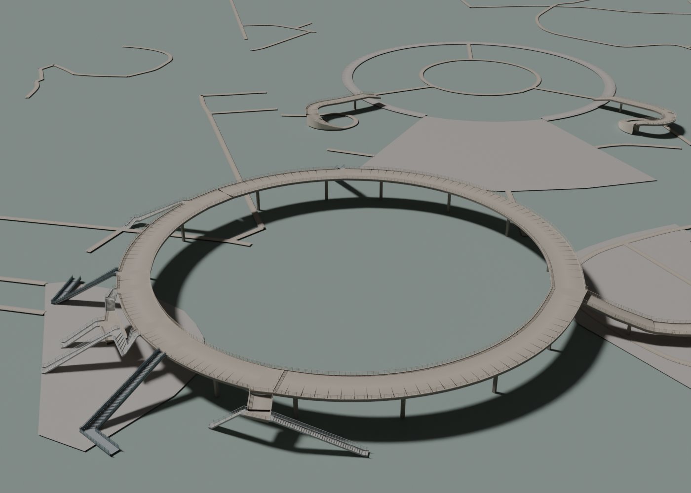 Approximate reconstruction of the Mingzhu pedestrian ring and its connections, rendered in Blender
An elevated ring can look right from above and fail as soon as the camera drops: stairs that do not reach the deck, railings cutting across an entrance, or a walkway that suddenly narrows. That is why we reviewed the Lujiazui bridges as connected routes, not isolated objects.
 Explanatory diagram, not to scale. It does not represent measured dimensions of Shanghai.
The question that reveals a bad connection
Can you visually follow the route from the pavement up to the deck, and from there to the next access? That question forces you to look at the ends and the joints. A handsome but disconnected bridge does not explain how people move through the place. The check assesses the model’s continuity; it does not certify real-world safety or accessibility.
Layer orders crossings: it does not measure height
OpenStreetMap uses layer to describe the vertical order where features cross. It is not a metric elevation. [layer] Assigning a fixed height to each value can produce a tidy picture, but it does not prove the height of any particular bridge.
In our renderer we keep the route’s function separate from the structure that carries it. A way can be pedestrian and elevated; a road can run through a tunnel. When measurements are missing, the elevation used for display must stay marked as an approximation. It is not enough for the upper crossing to sit above the lower one.
Why width must belong to each bridge
Renderer geometry exported to Blender to review Mingzhu. Surroundings hidden to study the connections; undocumented dimensions and details are approximate. Not a photograph.
A narrow footbridge, a platform and a distribution ring do not share the same cross-section. Mingzhu led us to apply a correction tied to the identity of that bridge, rather than widening every footpath in Shanghai. That boundary keeps a local decision from spreading to the rest of the city.
At a joint, check both edges as well as the centreline. Two connected centrelines can leave a gap between surfaces, an overlap or an overly sharp corner. Changes of width need a geometric transition that looks consistent both from above and from the street. A continuous railing must also break where another route comes in.
Stairs, lifts and landings
A stair has two ends at different elevations. Its run has to arrive on a landing surface. For a lift, the map location does not automatically describe doors, car, enclosure or all of its stops. We use the documented accesses to place the connections and leave undimensioned details approximate.
Putting a lift tower wherever it looks convenient would add a claim about the place that the data does not support. The same goes for a stair that disappears into a building: an interior connection may exist, but its geometry cannot be deduced from an exterior view. Record that gap as an open question.
| Symptom | Check first | Avoid |
|---|
| Floating access | Elevations at both ends | Moving the whole bridge by eye |
| Narrow joint | Deck widths and edges | Connecting only the centrelines |
| Generic lift | Documented location and levels | Inventing stops |
| Railing across an entrance | Opening and landing | Closing the whole perimeter |
A reusable review sequence
- Isolate the bridge Check the perimeter of the deck and where it meets neighbouring routes.
- Turn on the surroundings Add streets, buildings and terrain to look for clashes and elevation differences.
- Walk each access with the camera Look at it from above, from the side and at pedestrian height. One view is not enough.
- Keep the evidence Tie each correction to the map identifier, the date and the source; tell proposed extensions apart from existing structures.
The Lujiazui case documents which parts follow data and which are approximate. That traceability lets you review why we chose a shape, not just judge how it looks. [case]
Frequently asked questions
Does layer=1 mean one metre high?
No. Layer expresses the vertical order of features that cross each other; it is not an elevation in metres.
Does a continuous stair prove accessibility?
No. Visual continuity does not verify slopes, dimensions, whether lifts work, or accessibility requirements.
Keep exploring the Shanghai case
Shanghai Pedestrian Bridges in 3D: Heights, Stairs and Connections That Actually Fit